Friday, August 30, 2013

More Mount Baker Hiking With Cindy, Michele, Ginny & Jeremy

Last Sunday my great nephew Spencer Jack's grandma, she being my favorite ex-sister-in-law, Cindy, emailed me photos of her hiking trek to the Park Butte Lookout near the Mount Baker volcano.

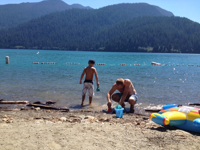
I then blogged about Cindy and her co-hiker, Michele, hiking to the Park Butte Lookout, in a blogging titled Hiking To The Park Butte Lookout With Cindy & Michele.

In that blog post I mentioned several things that I remembered about hiking to Park Butte. Things like the treacherous crossing of what I believe is called Sulfur Creek, with that creek being the melted water coming from the Easton Glacier on the slopes of Mount Baker. And how treacherous I remembered the hike up Park Butte to be.

That is the Park Butte Lookout you see in the above photo. It does not looks as treacherous as my memory remembers it.

Today Cindy emailed me a few more photos from her Park Butte Lookout hike, which illustrate some of what I mentioned in the previous blogging.

I also referenced, in that blogging, Pacific Northwest mountain hiking legend,  Dr. Fred T. Darvill. I'd infosearched Fred T. Darvill and found a memoriam. Dr. Darvill's wife, Ginny is mentioned in that memoriam.


After reading my reference to Dr. Darvill, Cindy sent the above photo with text saying that upon arriving at the Park Butte Lookout Cindy and Michele found someone painting the lookout. That someone turned out to be Dr. Darvill's wife, Ginny, she being the young lady between Cindy and Michele in the photo.

I do not know if by "painting" Cindy means Ginny Darvill was painting the lookout with a fresh coat of paint. Or if she was painting a water color picture of the lookout.

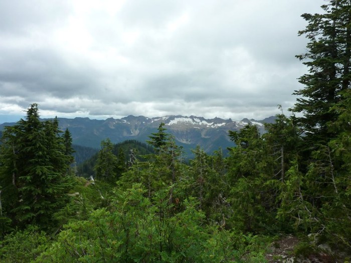
Below is a photo taken from the Park Butte Lookout, looking at the Railroad Grade, that being the name of the trail which runs atop the glacial moraine formed by the Easton Glacier. I am almost 100% certain I have this glacier named correctly. There are several on Mount Baker, Coleman Glacier and Deming Glacier come to mind.


That big slice of ice in the middle of the photo is the glacier. To the right, obscured by clouds, is the top of Mount Baker. That edge that follows the west side of the glacier is the Railroad Grade. Eventually you can go no further without proper ice/snow trekking gear. The last time I hiked the Railroad Grade was with my nephew, Joey. We hiked up to the far upper left of what you see in the photo. At that point you can clearly see the steam venting from Mount Baker's crater.  And smell the sulfur.

In today's email Cindy informed me that the bridge I was familiar with that crossed the glacier melt creek has been long gone, but was replaced a couple weeks ago by the temporary bridge you see below.


Crossing the creek did not look too treacherous for Cindy's most recent crossing, but she says 2 years ago, when she returned from hiking up the Railroad Grade, the return trip across the raging creek was scary.

I remember a couple times crossing that creek, late in the afternoon, where it took a long time because you had to be so careful not to get washed away by the rampaging water. The most recent time was a piece of cake because a well built suspension bridge took you over the creek, well above the water. That is the bridge that Cindy says has been long gone.

Now that I am thinking about that long gone bridge across Sulfur Creek I remember the last time I crossed that bridge. It was with a hiking group of 6 or 7, including my youngest nephew, Jeremy, about 7 at the time, 27 now.

When Jeremy saw the bridge that he was expected to cross he was not happy. It took a lot of coaxing to get him to cross. I remember Jeremy insisting both bridge ends be guarded.

Because Jeremy had watched in horror as several of the group crossed the bridge, having fun making it bounce and sway.

It took Jeremy about 10 minutes to slowly make his way across.

That hike was on a foggy, drizzly August day. By the time we got out of the woods, to the point you usually see Mount Baker, it was totally fogged in. We bailed.

When we got back to the point where the suspension bridge had to be crossed again Jeremy had developed a totally different attitude.

Jeremy's totally adjusted suspension bridge crossing attitude resulted in one of my all time favorite photos....


Wednesday, August 28, 2013

Captain Spencer Jack Piloting A Washington State Ferry In Anacortes

In the picture you are looking at my great nephew, Captain Spencer Jack piloting a Washington State Ferry at the terminal in Anacortes.

When Spencer Jack's dad, my equally great nephew, Jason, was a few years older than Spencer Jack he built the entire Washington State Ferry Fleet in scale model form.

Spencer Jack's dad's Washington State Ferry Fleet went up in smoke, under mysterious circumstances, at some point during the 1990's.

The Washington State Ferry Fleet is the biggest fleet of ferries in the United States. And the third biggest fleet in the world.

Based on the number of vehicles carried annually, at around 11 million, the Washington State Ferry system is the world's largest.

Washington State began ferry operations in 1951. Prior to that the ferry system, known as the "Mosquito Fleet" was a private business operation, with multiple operators, which by 1935 had been reduced to one company operating a fleet, that being the Puget Sound Navigation Company, nicknamed the Black Ball Line.

By the end of the 1940s the Black Ball Line was having labor relations woes with the ferry worker's union, which was demanding wage increases. The Black Ball Line wanted to raise its fares. But the state said no to fare increases. The Black Ball Line then shut down, with the State of Washington taking over ferry operations after paying Black Ball $5 million for all but 5 of its ferry boats.

When the State of Washington took over running the ferry system, in 1951, conventional wisdom of the day thought the state would only run the ferry system until bridges across Puget Sound were built. However, for the most part, no bridges were built, which has the Washington State Department of Transportation still in the ferry business over a half century later.

Cross sound bridges to take the place of ferry boats? Those would be some mighty big bridges. A bridge from Keystone on Whidbey Island to Port Townsend on the Olympic Peninsula? A bridge from downtown Seattle to Bainbridge Island? Bridges from Anacortes to the San Juan Islands?

Cross-sound bridges? Washington would not be Washington without its ferry fleet.

Sunday, August 25, 2013

Hiking To The Park Butte Lookout With Cindy & Michele

Looking West at the Sisters Mountain Range in the Background
In the photo you are looking at my great nephew Spencer Jack's grandma, my favorite ex-sister-in-law, Cindy, with her hiking partner, Michele, at the Park Butte Lookout, near Mount Baker in the Mount Baker - Snoqualmie National Forest.

Last week it was Maxine making me homesick for hiking the Cascade Mountain trails, with Maxine's tales of hiking to Hidden Lake and Park Butte.

I have only hiked to Park Butte one time. I remember it as a difficult hike.

The last time I hiked from Schrieber's Meadow to the Park Butte Lookout trail  zone was with Cindy's youngest, Spencer Jack's uncle, my favorite nephew, Joey. On that hike Joey and I did not hike up to the Park Butte Lookout. We hiked up what is called the Railroad Grade, that being the trail atop the glacier moraine carved out by the Easton Glacier.

Speaking of the Easton Glacier. During warm summer days that glacier melts copious amounts of water. Early in the day this is no big deal. But, by late afternoon the glacial melt becomes a torrent that can be a bit treacherous to cross. Bridges get built and then washed away. I don't know what the current bridge status is regarding the streams one crosses between Schrieber's Meadow and when you begin the climb up the Mount Baker foothill.

Go here to see photos of one of the aforementioned bridges and the hike with Joey up Mount Baker.


In the above photo from Cindy we are looking east towards Baker Lake. Cindy says you can see Baker Lake in the middle of the picture.

The hike to the Park Butte Lookout is 4 miles, making this an 8 mile round trip. The altitude gain, counting ups and downs, is 2,200 feet. The trailhead is 3,350 feet above sea level.

In his book, Hiking the North Cascades, Fred T. Darvill, Jr. says of the Park Butte hike, "The view from Park Butte is one of the best in the North Cascades; this may be one of the most beautiful places in the world. Dominating the scene is the ice-clad cone of Mt. Baker with its satellite peaks, the Black Buttes..."

Fred T. Darvill is sort of a Pacific Northwest mountain legend. In addition to being an ardent hiker and author, he was a doctor. I Googled "Fred T. Darvill" to find a memoriam webpage dedicated to his memory. The first entry in that memoriam is below...

Dr. Fred Darvill MD passed away on December 29. He practiced medicine for 50 years in the Skagit Valley. When his heart wasn't active helping his patients it was climbing peaks in the Cascades. He wrote several books including Stehekin: The Enchanted Valley and Hiking the North Cascades. For twenty years he and his wife Ginny devoted time, energy, and resources toward their adoption of the Hidden Lakes Lookout. Several years ago I found Fred's name written on a summit register. He had placed the register in 1967 at the unnamed highpoint between Desolation and Hozomeen peaks. Our visit was the sixth party to enter the register in nearly 40 years. As he had left his card I called his home and spoke with Ginny. She said she would mention my visit to him and it would probably help him reflect on more pleasant times. His struggle in the closing years was with Alzheimer's. Those who would like to provide a tribute to his service can donate to the Alzheimer's Association or Doctors Without Borders at the request of his wife Ginny.

Tuesday, August 13, 2013

Mudsldes Stop Me From Driving North Cross Cascades Highway 20 To Winthrop This Weekend

I did not know til Maxine told me via email that thunderstorms over the weekend dropped a lot of water on the North Cascades, which caused 8 mudslides between mileposts 150  and 155 on Highway 20, near Rainy Pass.

Highway 20 is now closed at the winter gate at milepost 147, east of Diablo. Coming from the east the highway is closed at milepost 157, east of Rainy Pass.

The biggest of the Highway 20 mudslides is a quarter mile long and 25 feet deep.

Did any vehicles passing over the pass get trapped in the Highway 20 mud mess?

The same storm also caused a major washout on the Cascade River Road at milepost 18. Cascade River Road is how you get to the trail head for the Cascade Pass Trail, which is one of the most popular hiking destinations in the Cascade Mountains. The Cascade Pass Trail is the route one hikes from the west side of the mountains to hike to the Stehekin Valley.

The aforementioned Maxine makes a yearly trek to Stehekin via this route.

The washout on the Cascade River Road stranded 65 hikers and 30 vehicles at the Cascade Pass trail head parking lot. The stranded hikers had to spend the night. By Monday a temporary fix to the washout let the stranded evacuate.

That Washington Trails Association has an excellent website with photos and details about the closed roads.

The Seattle Times has an excellent first person account from one of the stranded Cascade Pass hikers.

Wednesday, August 7, 2013

Walking Across Upper Baker Dam With Spencer Jack

In the picture you are looking at my great nephew, Spencer Jack, taking a picture of the Mount Baker volcano.

This past weekend Spencer Jack took his dad and favorite girl friend, Brittney, to the Mount Baker-Snoqualmie National Forest to drive and walk across the Upper Baker Dam.

And to swim in Baker Lake which has been rendered a pleasant swimming temperature, due to the unusually warm summer Western Washington has been experiencing.

Upper Baker Dam opened for business in 1959.

Upper Baker Dam serves the dual purposes of generating electricity and providing flood control.

The dam is 312 feet high, 1,200 feet long.

Despite this being an era of heightened security, you can still drive across Upper Baker Dam, which is not the case with Grand Coulee Dam.

Driving across Rocky Reach Dam, on the Columbia River, has never been doable, but Rocky Reach Dam has a lot of tourist amenities, like fish ladders and a big interpretive center, which now require security checks.


Above Spencer Jack is aiming his camera over the edge of Upper Baker Dam. You can see blue water 312 feet below.


Above Spencer Jack is still on the Upper Baker Dam, turned around, taking a picture of the reservoir known as Baker Lake.

Upper Baker Dam has that name because downriver, that river being the Baker River, there is another dam, known as Lower Baker Dam, or just Baker Dam, so known because it showed up long before Upper Baker Dam, with Lower Baker Dam opening for business in 1925.

Lower Baker Dam is 285 feet high, 550 feet long. Lower Baker Dam dams a section of the Baker River known as Eden Canyon. The reservoir behind Lower Baker Dam is known as Lake Shannon. Lower Baker Dam also generates electricity and helps with flood control, holding back water from entering the Skagit River, about a mile downstream.


Above we are looking at Spencer Jack, and his dad, my favorite nephew, Jason, playing in Baker Lake. I don't know why Spencer Jack's uncle, he being my favorite nephew, Joey, was not along for this excursion.